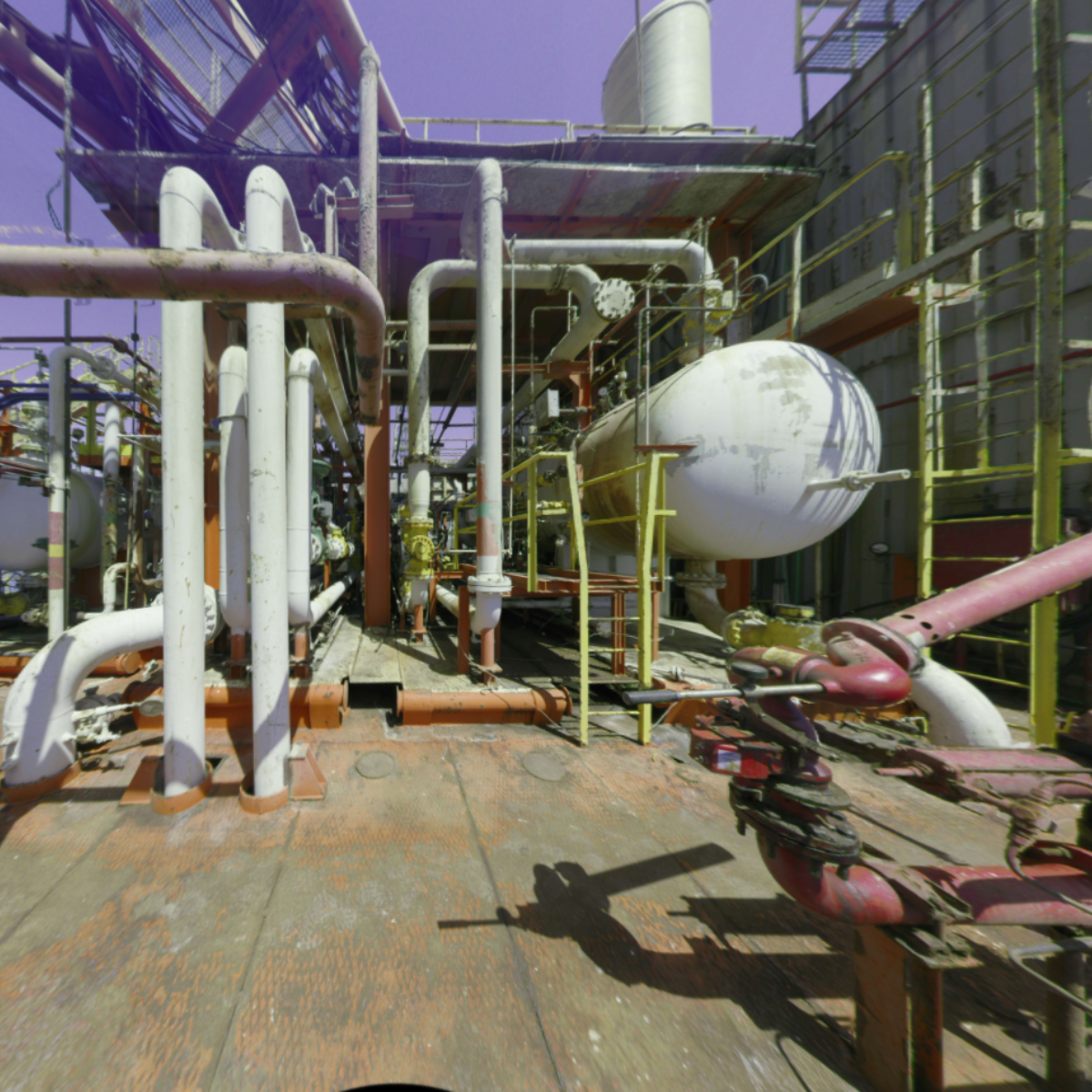
Laser scanning and 3d modeling
Key benefits
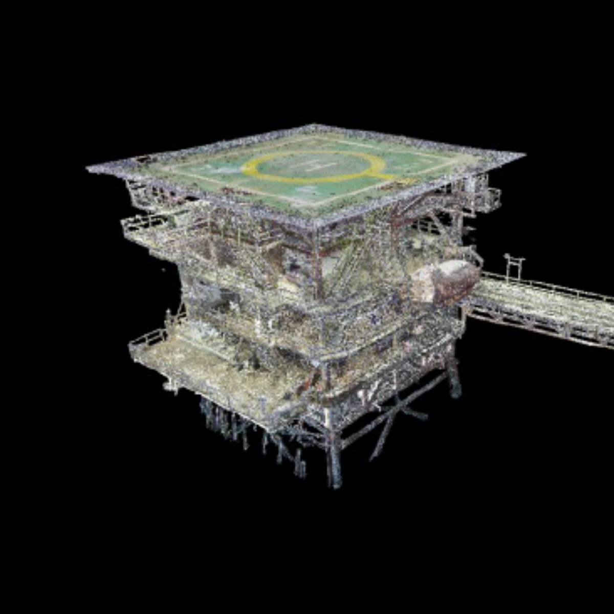
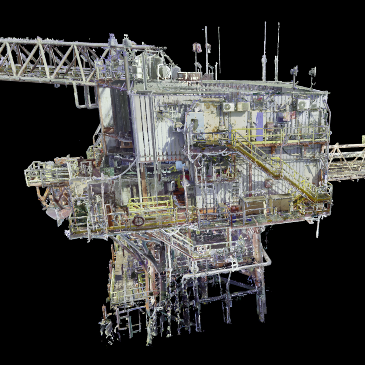
Laser scanning provides extremely detailed measurements with millimeter-level precision, ensuring reliable data for critical decisions. Whether for structural assessments, retrofits, or modeling, the accuracy eliminates guesswork and reduces the risk of costly errors down the line.
Compared to traditional survey methods, laser scanning is significantly faster. It captures millions of data points in just minutes, enabling comprehensive coverage in a fraction of the time, reducing man-hours and minimizing disruption to operations—especially valuable in offshore environments.
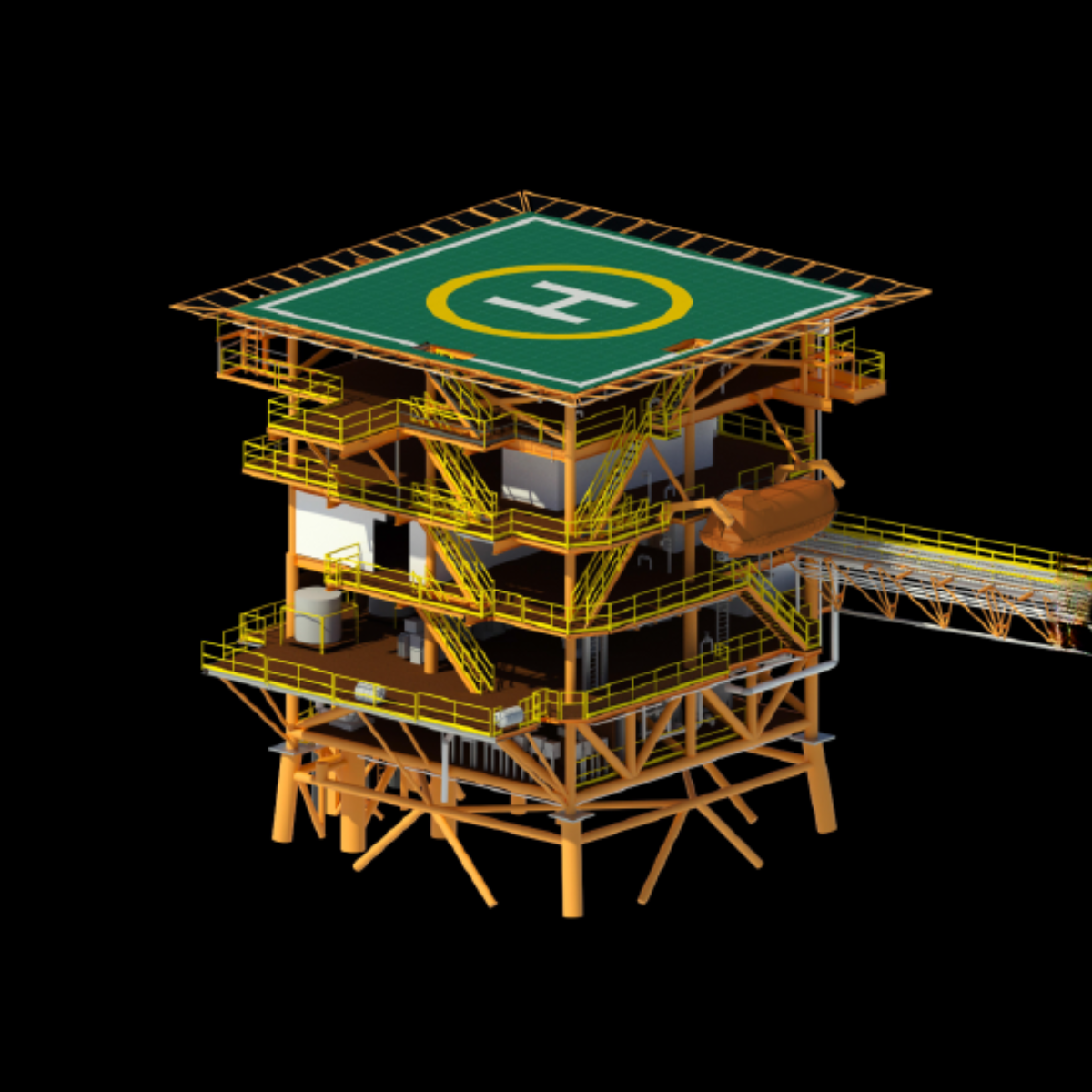
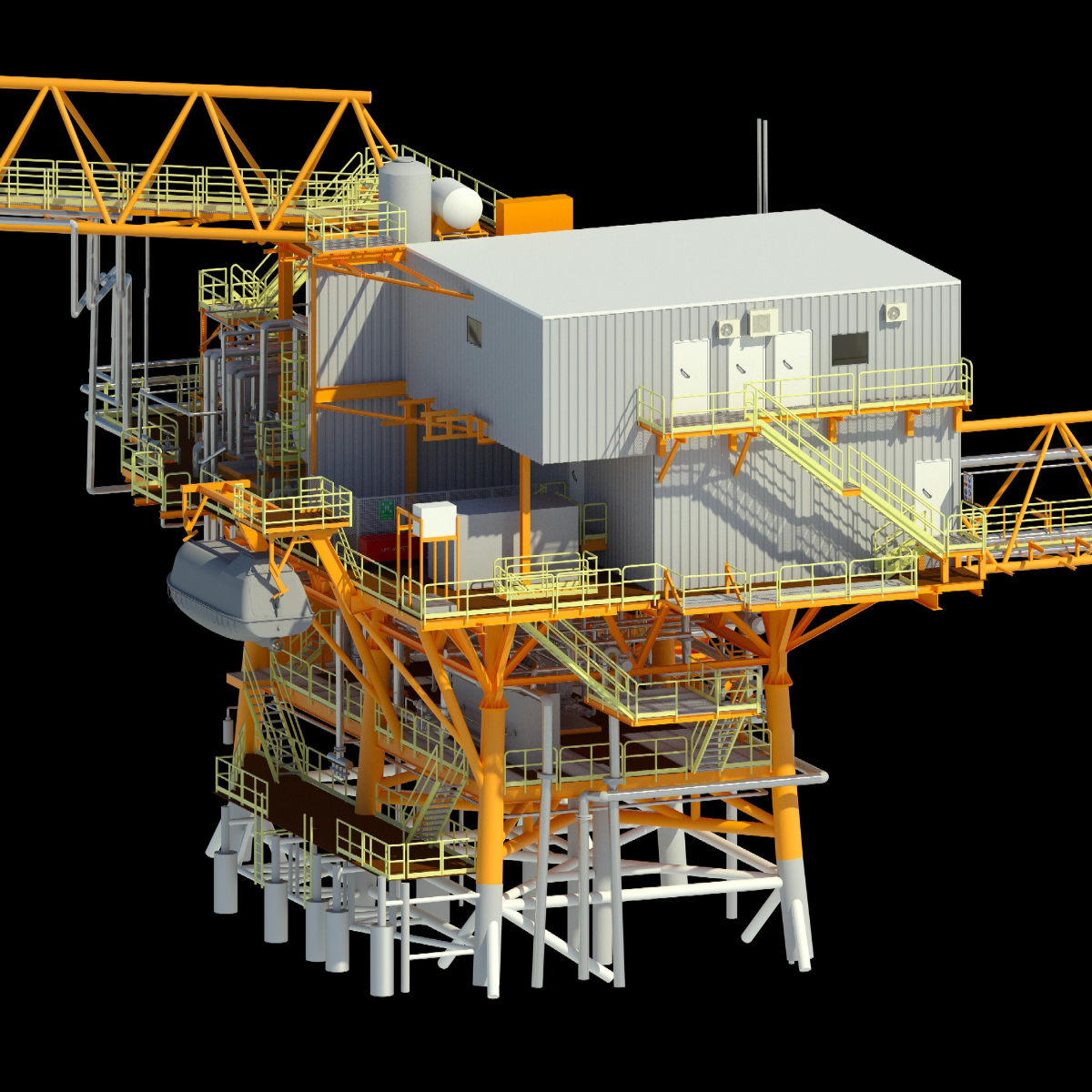
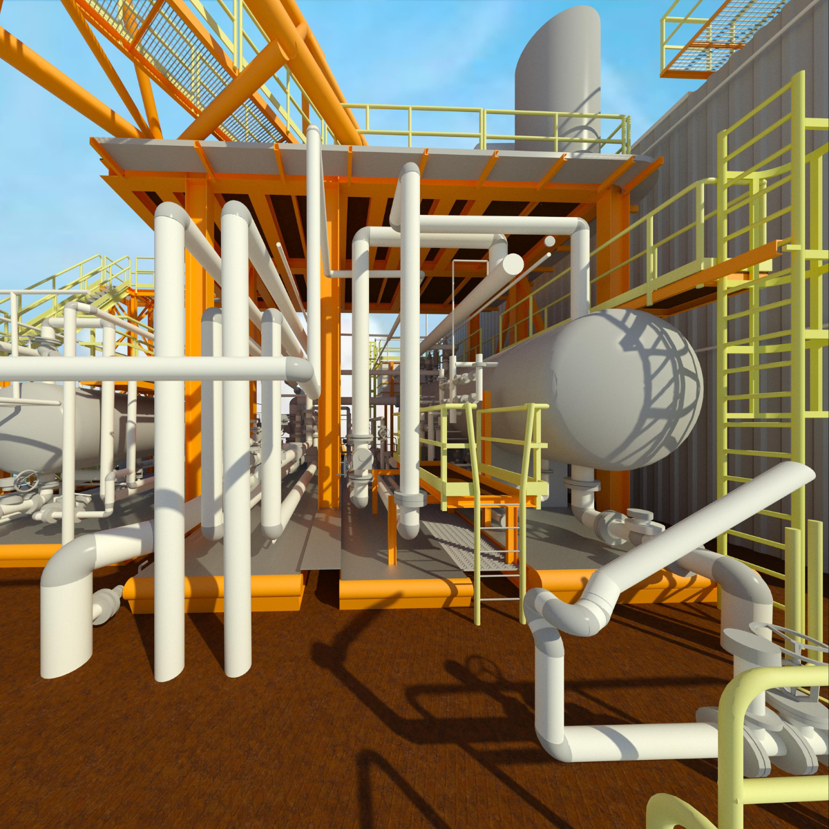
Scans result in rich, dense point clouds that can be processed into 2D drawings, 3D models, digital twins, and more. This provides engineers, designers, and project teams with flexible deliverables tailored to their workflow needs, from AutoCAD to BIM platforms.
Laser scanning can be conducted from a distance, reducing the need for personnel to access hazardous or difficult-to-reach areas. This makes it ideal for high-risk environments, ensuring safety while still capturing accurate data.
With access to detailed 3D data and visualizations, teams can perform clash detection, spatial analysis, and verify structural alignment before making any physical changes. This proactive approach reduces rework, delays, and budget overruns.
Whether you’re working on a small-scale renovation or a large-scale offshore installation, our laser scanning service is fully scalable to meet the needs of your project. We can quickly adapt to various project scopes, ensuring that no matter the size or complexity, you receive high-quality, accurate data on time and within budget.
why sims offshore?
Our in-house technicians are trained in the latest laser scanning technologies. With a focus on safety, accuracy, and efficiency, our technicians are equipped to handle complex site conditions while maintaining the highest standards of data integrity.
With a proven track record in offshore operations, oil & gas, engineering, and marine industries, Sims Offshore understands the demanding conditions and precision requirements of the field. We apply this industry insight to every project, ensuring results that meet real-world expectations and compliance standards.
We invest in the latest laser scanning technologies and software platforms to deliver high-resolution 3D point clouds and models. This includes industry-leading scanners capable of capturing data quickly, accurately, and in high-definition—even in challenging environmental conditions.
No two projects are the same. That’s why we tailor our scanning workflows and deliverables to match your project’s specific scope, timeline, and data requirements. From basic as-built scans to complex 3D modeling for design integration, we adapt to fit your goals.
Sims Offshore offers a suite of digital capture and analysis services—including Photogrammetry, 3D Modeling, and Point Cloud Processing. By integrating Laser Scanning with these capabilities, we provide clients with a comprehensive, one-stop solution for spatial data acquisition, project visualization and integrity management.
Every project is executed with a strong emphasis on quality control and health & safety protocols. We follow strict QA/QC procedures and are compliant with industry regulations to ensure that both data and operations are consistently reliable and safe.